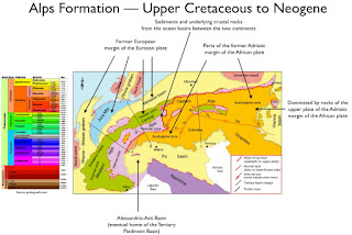
The most recent activity in European mountain-formation began with the initial compression caused by subduction of the European plate under the African plate in the Jurassic period. Collision between the African and Eurasian plates resulted in increased deformation of Tethyian Sea deposits. The orogeny "produced intense metamorphism of preexisting rocks, crumpling of rock strata, and uplift accompanied by both normal and thrust faulting." Remnants of the Tethys Sea remain as the Mediterranean, Black, Caspian, and Aral Seas. The plate movement resulted in the Italian peninsula being driven northward and compressed into Europe.
At the "conclusion" of the Alpine orogeny, the area that is now Colli Tortonesi did not exist in its current form; rather, it was the eastern portion of a basin that rested beneath a remnant of the Tethys Sea -- the Tertiary Piedmont Basin (TPB) -- separated from another wedge-top basin -- the Epiligurian Succession -- by a tectonic fault called the Villalvernia-Varzi (VV) Line. Colli Tortonesi is roughly positioned on the sketch map below. I discuss the basement, the VV fault, and the successions in the material following.
The Colli Tortonesi Basement
In the Oligocene - Miocene, Ligurian Units, comprised of fragments of the Ligurian-Piedmony Ocean basin and the transition zone to the Adria continental margin, was carted onto the more external domains corresponding to the continental margin of Adria (Tuscan-Umbrian domain). The resulting structure is illustrated in the chart below.
The figure shows the Villavernia-Vernia Line, a prominent feature throughout the entire basement profile. As shown in the figure, VVL separates the TPB from the Epiligurian Units.
Villalvernia-Varzi Line
The characteristics of the line are illustrated in the chart below.
Tertiary Piedmont Basin
As shown in the chart above, the TPB is located to the south of the VV Line.
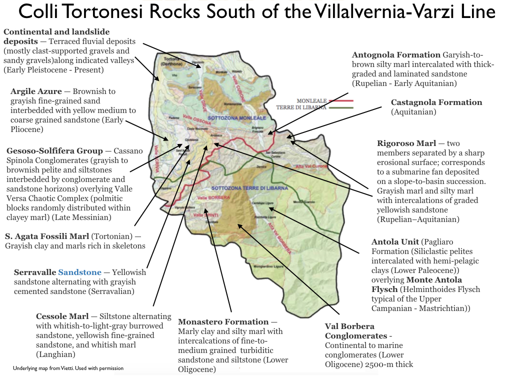
Beginning in the late Eocene, the Tertiary Piedmont Basin (TPB) developed within the Epimesoalpine Basin and "sealed the meso-Alpine deformations caused by various tectonic units ranging from the Ligurian Alps (Voltri Group, Brianconnais) to the Northern Apennines (Ligurian Units)." The TPB is divided into three sectors -- western (Langhe). central, and eastern (Borbera-Grue) -- by the Celle-Sandia and Sestria-Voltaggio fault lines. The sedimentary succession, and underlying basement rocks, are present in all three sectors, as shown in A below.
 |
A - Deposits in the basin (Source: The Tertiary Piedmont
Basin, Mufti, et al.); B - Age ranges in the Stages of the Miocene
(Source: Wikipedia); C - Composition and depths of Oligocene
and Miocene deposits (Source: Mufti, et al) |
The TPB sedimentary succession began in the mid-Oligocene and continued through the Miocene. A (above) shows the population of sedimentations by geographic era while C shows the types and extent of sedimentation, exclusive of the Messinian period. The deposits through the Tortonian are predominantly terrigenous in nature -- that is, originating from land -- and are primarily sandstones and mudstones. At its deepest points the succession records a thickness of 6000 m (Mutti, et al.).
The Borbera Valley succession, the area of import for our purposes, is characterized by the sedimentary succession beginning with the Val Borbera conglomerates -- a 2500-m-thick layer of continental-to-marine conglomerates from the Lower Oligocene. In the Costa Merlassino area, Sandstone of Ranzano and Marls of Monte Piano are interposed between the Val Borbera Conglomerates and the Antola Unit. The Middle-Borbera-Valley succession is illustrated in the chart below.
The eastern (Borbera-Grue) sector:
- Exposes the lowermost part of the sedimentary succession of the TPB (upper Eocene)
- Experienced, during the Oligocene and Miocene, a major phase of subsidence, leading to the deposition of relatively deep-water turbidites
- After the Burdigalian, and concurrently with a phase of dramatic inversion of the entire basin, experienced a progressive uplift expressed by a general shallowing upward of the depositional profile.
External Ligurian Units and Epiligurian Unit
Epiligurian Units are found in the wedge-top basin to the north of the VV Line and describes the deposits into that basin between the Middle Eocene and Middle Miocene. The succession is illustrated graphically below.
Quaternary Succession
Quaternary deposits are 2.5 million years old and younger. All of the Quaternary deposits found in the region are located along the valley floors, indicating river-driven migration.
 |
Quaternary soils in Colli Tortonesi
(Underlying map from Vietti. Used with permission) |
Conclusion
The chart immediately below shows the distribution of rocks in the areas to the north and south of the Villalvernia - Varzi Line, inclusive. The chart indicates four distinct tectonic periods on the TPB-side of the line and "relative" calm in the area above.
This chart summarizes the successions in the VVZ area and provides detailed descriptions of each rock formation encountered.
 |
| Source: https://www.unito.it/sites/default/files/temi_geologo_ii_2015_allegato1.pdf |
©Wine --
Mise en abyme